
NJ weather: Watching two storm systems, as temperatures warm up
The Bottom Line
After two days of arctic chill, I am ready for a warmup. And, as November turns to December, we will flip to the mild side. We will be able to celebrate and exalt temperatures climbing into the 50s through the upcoming weekend.
But there are a pair of storm systems we are watching too: one arriving on Friday, and another on Sunday. Each will carry a chance of rain, putting a damper on outdoor plans and making travel a little sloppy. However, there is no risk of anything heavy, severe, or (most relevantly) wintry.

Thursday
It is still cold Thursday morning. Temperatures have bottomed-out in the 20s across most of the state, although the immediate coast is holding just above the freezing mark.
You will definitely notice a difference by Thursday afternoon. HIgh temperatures will push into the upper 40s to around 50, a full 10+ degrees warmer than Wednesday.
Sunshine will dominate the morning, before clouds slowly build in the afternoon. Weather stays dry, and winds should stay below the "breezy" category all day.
Thursday night will be seasonably chilly. But most of New Jersey should avoid a freeze. Average low temperatures will drop to the mid 30s by Friday morning.
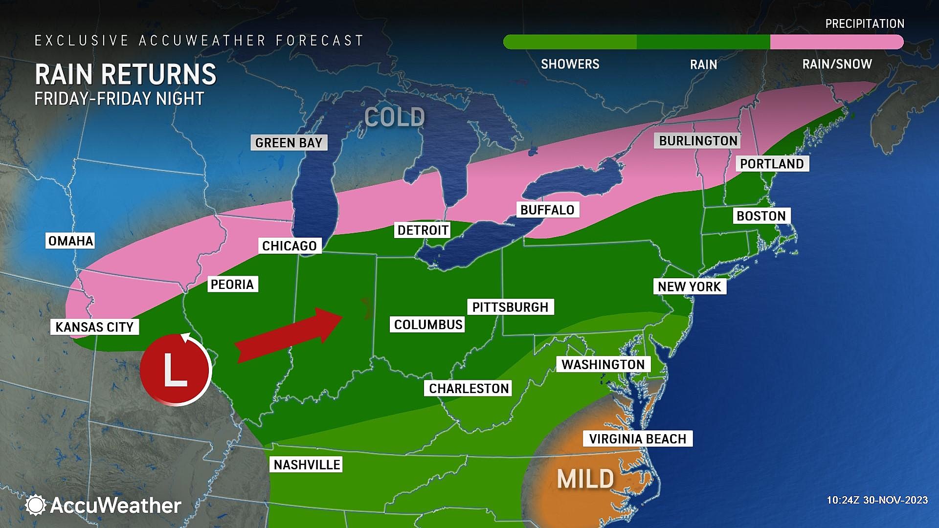
Friday
The warmup continues, as highs push into the lower 50s. But it will not be a dry weather day.
The morning will be fine. Then spotty showers come into play starting around Friday early afternoon. Rainfall could become more widespread and steadier in the evening rush hours and dinnertime hours. And then raindrops depart by late evening.
As I mentioned, rainfall will be on the light side. And there is no risk of wintry weather at all, thanks to that influx of warmer air. Friday will not a washout — just a few hours of wet weather, potentially requiring a hood, umbrella, and/or windshield wipers.
Temperatures will also stay above freezing Friday night — mainly in the 40s — so there is no risk of icy puddles.
Saturday
Saturday has potential. My only concern is cloud cover — it could look pretty gray overhead, like the sky could open up at any moment. But at least temperatures will be on the mild side, reaching the mid 50s. (Some models even go as high as 60+ in South Jersey.)
The chance of rain on Saturday is not quite zero. The GFS in particular now favors some showers clipping southern NJ Saturday evening. So I have opted for a description of "probably dry" in my official forecast.
Sunday
We get wet again, as a storm system slides in from the south.
There is still a wide variety of solutions for the timing, spread, and amount of rainfall on Sunday. Again, I don't think it will be a total washout — meaning rain literally from dawn to dusk. But Sunday does not look like a very pretty day either.
That is especially unfortunate, given high temperatures around 55 to 60 degrees.
Pockets of rain may arrive before sunrise Sunday morning, with occasional showers lasting as late as about Midnight. We may tap into some better dynamics (juicier air and stronger winds aloft) around the late afternoon or early evening hours, which could produce a quick downpour, rumbles of thunder, or elevated wind gusts.
I am not ringing any severe weather alarm bells for Sunday. But the rain does look a bit more impactful than Friday's showers.
Everyone should pick up a tenth to a quarter inch of rain, which does not amount to much. But if steadier, heavier rain picks up, totals may exceed a half-inch. Healthy, but not quite heavy.
The Extended Forecast
The good news about that Sunday storm system is that all models now keep Monday dry. As long as we get late clearing and our next infusion of cold air holds off, it should be a nice day. High temperatures should be locked into the 50s for one more day.
The bluster returns on Tuesday, as our weather turns cold and windy again. Highs in the 40s (at best), with wind gusts to 30+ mph.
There are no significant snow threats on the horizon for New Jersey, in the next one to two weeks.
LOOK: Highest-rated free things to do in New Jersey, according to Tripadvisor
Gallery Credit: Stacker
Dan Zarrow is Chief Meteorologist for Townsquare Media New Jersey. Follow him on Facebook for the latest forecast and realtime weather updates.
LOOK: Biggest snowfalls recorded in New Jersey history
Gallery Credit: Stacker
More From Cat Country 107.3


