
Another summerlike warmup on the way, but not for all of NJ
The Bottom Line
A warmup kicks in Wednesday, lasting for about 72 hours. There are a few hiccups to talk about — wildfire danger, on-shore breezes, etc. But this will be a stretch of beautiful, warm weather carrying through the start of the weekend. From the 60s to the 70s to the 80s.
There is only one chance of rain in the forecast over the course of the next week, smack in the middle of the weekend. Hopefully we'll get a good enough soaking to reduce the wildfire threat, drought risk, and pollen levels.

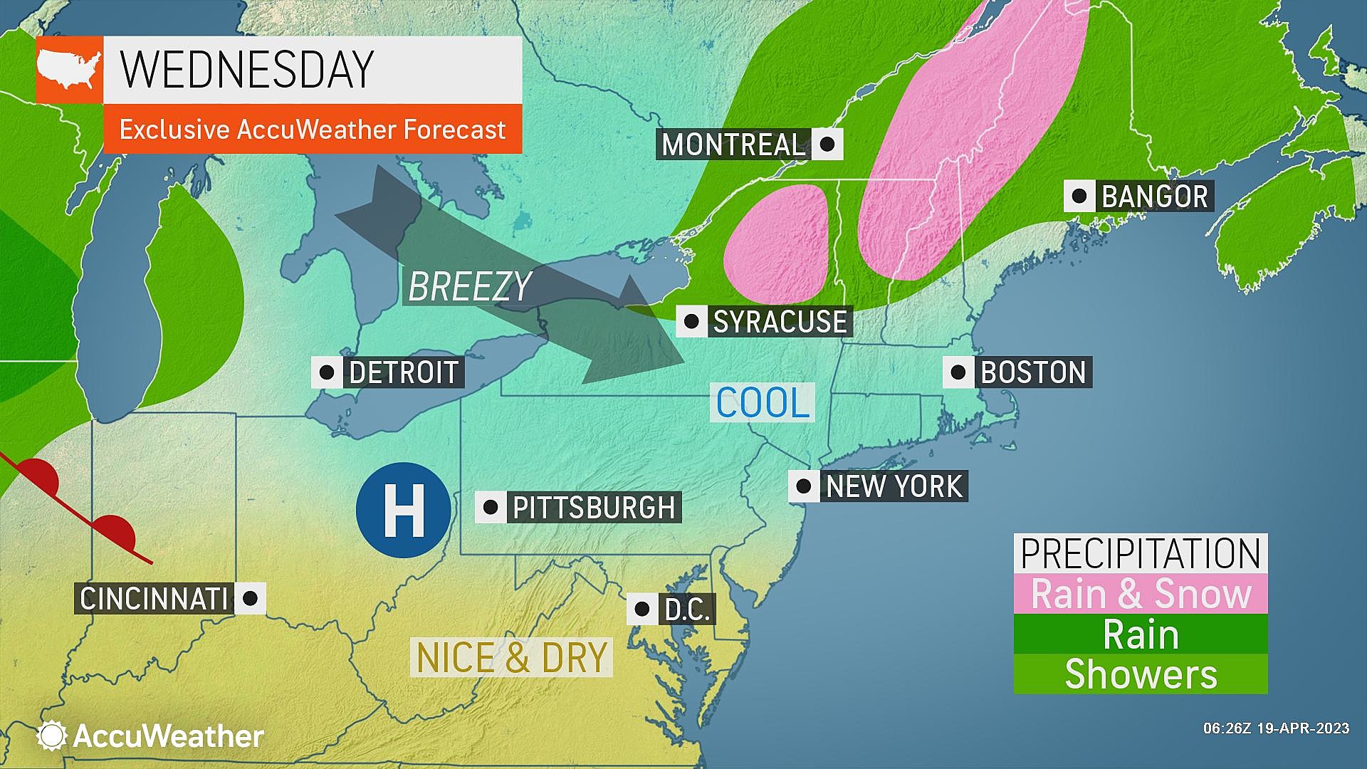
Wednesday
First of all, it is cold to start Wednesday. Our coldest morning in just over a week in fact. Temperatures are in the 30s and 40s — most New Jerseyans will be reaching for a jacket for sure.
Wednesday will not be as blustery and gusty and chilly as Tuesday. But still breezy, with westerly gusts to about 20 mph.
We will get lots of sunshine, with a few visiting clouds from time to time. It will be a dry day from start to finish. High temperatures should end up around 60 to 65 degrees — par for the course for this time of year. So I think it's fair to call today a pleasant mid-April day.
We do have a Red Flag Warning posted for all 21 counties again Wednesday, in effect from 11 a.m. to 8 p.m. Yes, high wildfire danger again, due to that combination of elevated winds and dry conditions. Burning anything outdoors — even making a spark or ember — is a really bad idea.
Wednesday night, the wind will calm down and skies will stay clear. Thermometers will bottom out in the seasonably cool 40s.
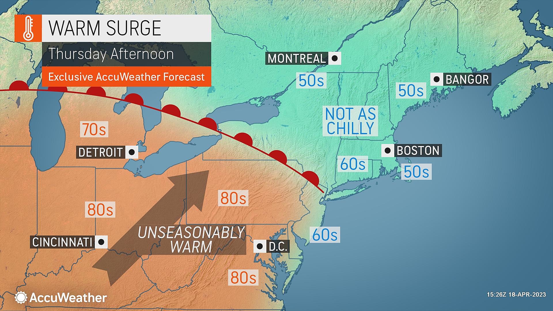
Thursday
A beautiful, mild day for most of the Garden State.
Under partly sunny skies, the majority of NJ towns will warm into the lower 70s on Thursday.
However, the wind will be blowing from the east-southeast.
Uh-oh. That's an on-shore breeze. Those are warmth killers for the Jersey Shore in the springtime, thanks to chilly ocean temperatures only around 52 to 55 degrees right now.
I expect some NJ beaches to get stuck in the 50s at best Thursday. Much cooler than just a few miles inland. It is impossible to pinpoint exactly how far inland the cooler, ocean air will impact — but the Garden State Parkway is a good general landmark.
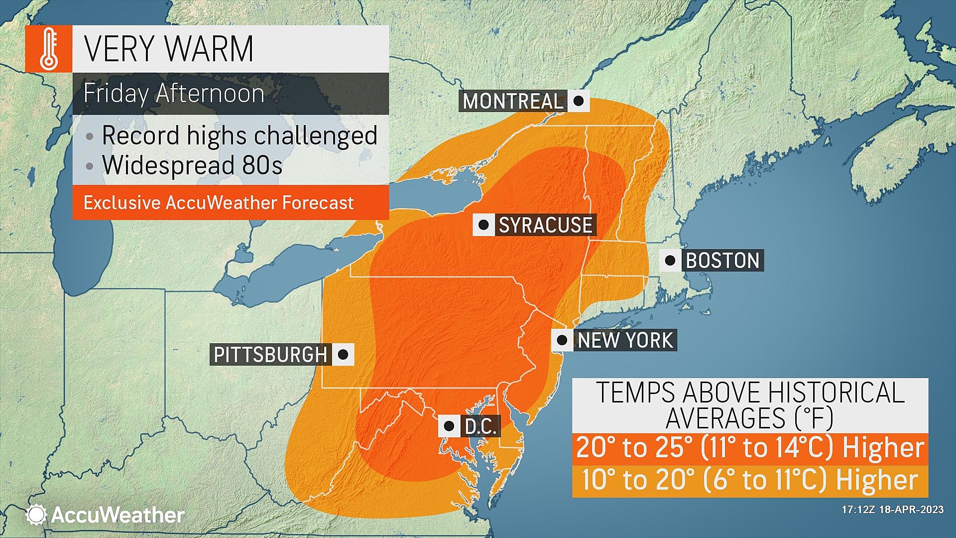
Friday
The warmest day of the week. But be careful about planning an April beach day.
Inland highs push into the lower 80s. (For the southwest corner of the state, at least.) However, areas along the coast will struggle to hit 60 degrees. A full 20 to 30 degrees colder.
Friday will start with bright skies in the morning, with clouds progressively building through the evening. While the GFS model puts a tiny isolated shower over NJ late-day, I'm keeping a dry forecast.
Saturday
Once again, the weekend forecast is all about change. But once again, Saturday's daytime hours should fare OK.
Skies will be mostly cloudy to overcast, keeping temperatures slightly cooler in the 70s. (Possibly 60s along the beaches.) It will be breezy too.
I'm keeping dry weather through the daytime hours on Saturday. But a band of rain is forecast to push from west to east across New Jersey from Saturday evening through Sunday morning. Total rainfall of a half-inch to an inch is possible. There could be some rumbles of thunder, and maybe some gusty winds.
Sunday
Latest guidance shows rain making a clean exit around daybreak Sunday. Having said that, I would not rule out some lingering showers or a later timeline for rain. Wet weather could linger into the start of Sunday's daytime hours.
The rest of Sunday will feature slowly clearing skies, a stiff breeze, and a return to seasonable temperatures in the 60s. Not too shabby, as long as the rain doesn't loiter.
The Extended Forecast
Early next week trends seasonably cool, with high temperatures around the lower 60s amid a mix of sun and clouds. Long-range models show a return to more active weather, with a string of storm systems driving in rain starting late next week. No complaints here — we really need the rain. As always, we will just have be vigilant for any threat of severe weather or flooding.
Dan Zarrow is Chief Meteorologist for Townsquare Media New Jersey. Follow him on Facebook or Twitter for the latest forecast and realtime weather updates.
RANKED: Here Are the 63 Smartest Dog Breeds
Gallery Credit: Sabienna Bowman
WOOF: These are the most popular dog breeds in America
Gallery Credit: Sabienna Bowman
More From Cat Country 107.3


